AAJ

The Line: Global Ambition

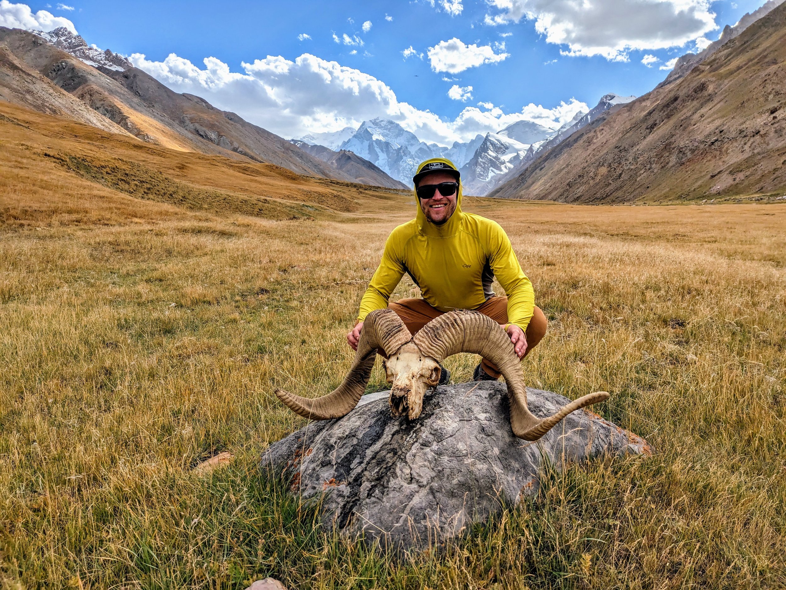
Read how a professor of mechanical engineering at Seattle University solved a geographic mystery in Uzbekistan and made the first known ascent of that nation’s highest peak. (This same peak was also No. 141 in the professor’s quest to summit the high point of every country in the world.) Plus: attempting Everest, climbing Kangchenjunga, completing the “Seven ’Stans,” and becoming a Snow Leopard—just a few recent accomplishments in the very busy life of Eric Gilbertson.

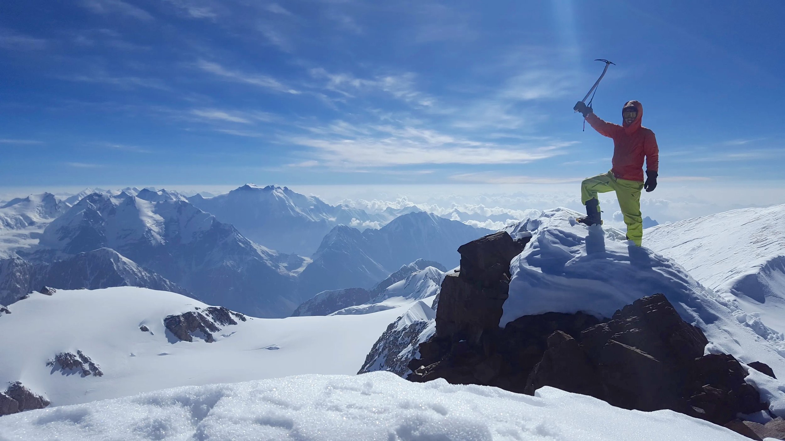
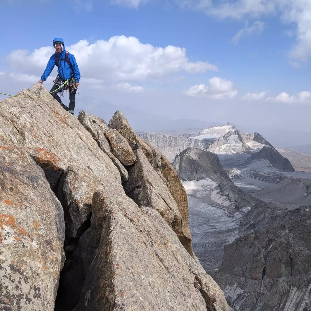
Nearing the summit of Alpomish. Photo: Eric Gilbertson.

The following is adapted from a report by Eric Gilbertson for AAJ 2024.

Alpomish:
The First Ascent

Until recently, it was widely accepted that a broad, rocky 4,643-meter mountain in the Gissar Range, on the Uzbekistan-Tajikistan border, was the highest peak in Uzbekistan. This was based on the 1981 Soviet topographic map, the most accurate and recent map of the area. (In recent times, some online sources have called this mountain Khazret Sultan, but this is incorrect.) While researching Peak 4,643, possibly first climbed by Soviets in the 1960s, I realized that a border peak about six kilometers to the south, known as Alpomish, was potentially taller than Peak 4,643. Andreas Frydensberg (Denmark) and I laid plans to carry a differential GPS unit and sight levels to both summits and determine which was higher.

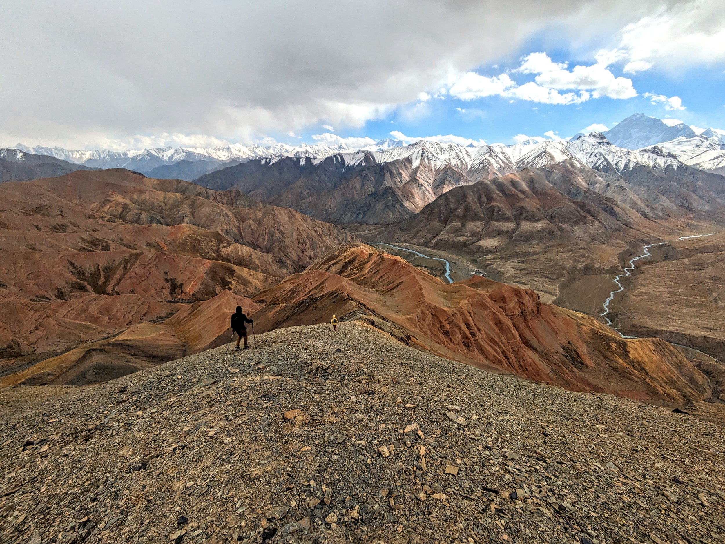
Acclimatized from ascents of Pik Korzhenevsky (7,105m) and Pik Ismoil Somoni (Pik Communism, 7,495m) in Tajikistan, Andreas and I headed to the Uzbekistan border region, and on August 21 we started our approach from Sarytag village. We hiked southwest alongside the Dikondara River, cached a few days of food, and continued south over several glaciated 4,000-meter passes and many talus fields, around 23 kilometers in total. Our base camp was by an unnamed glacier below the steep east face of Alpomish.

The first known ascent of Alpomish, by the east face (5.8). The rock wall is about 400 meters high. Photo: Eric Gilbertson.

The four-spired peak loomed above camp with 400-meter granite faces on each spire. The southernmost spire looked to be the tallest, which I verified with sight levels.

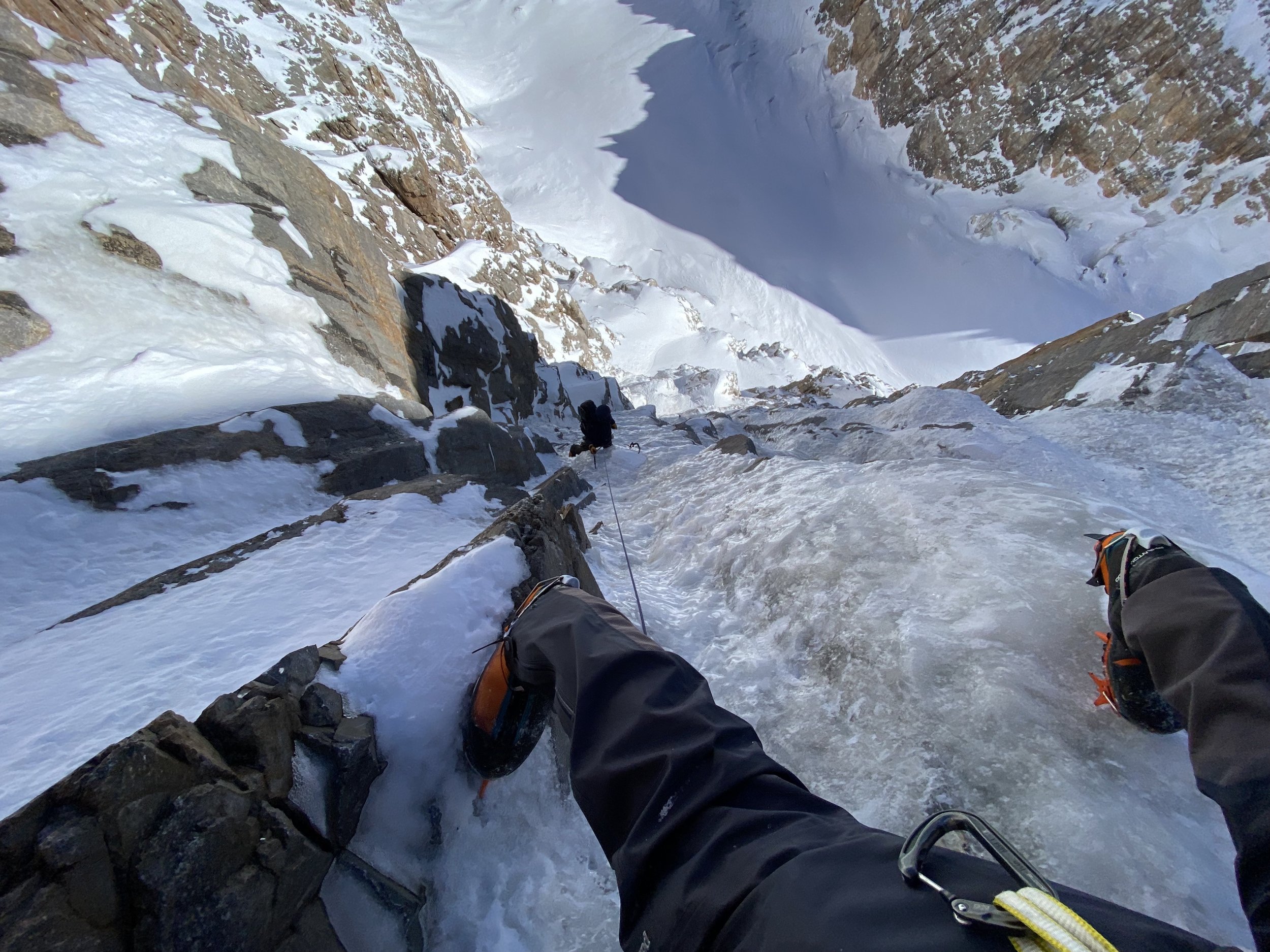
On August 23, we hiked to the east face and scrambled up a big gully on scree until it was blocked by a huge chockstone. I led a rock face then traversed left delicately to reach the top of the chockstone. Above a waterfall in the gully, ice continued all the way up to the notch, and since we’d left our ice gear below, we climbed the rock wall and ridge crest to the left. Once on the gendarmed summit ridge, a final knife-edge brought us to the top.

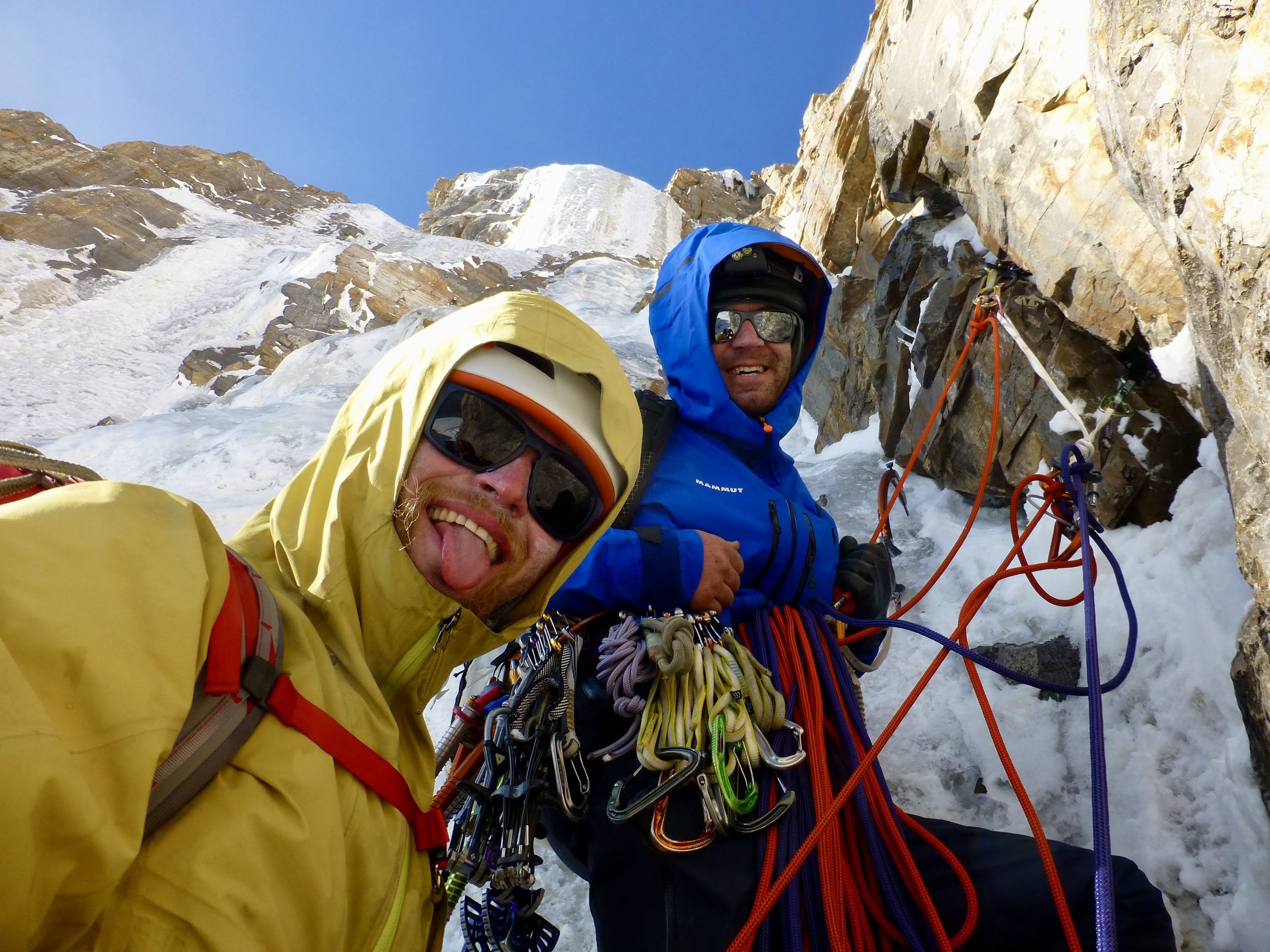
Using the sight levels, I first verified that all the nearby spires of the peak were shorter—we were definitely on the highest point of Alpomish. I set up the differential GPS, but it had trouble acquiring satellites. So I pointed my sight levels toward Peak 4,643, and with each level measured 10min–20min angular declination looking down at the distant summit. Clearly it was lower. There were no anchors, cairns, or any sign of human passage anywhere on Alpomish, so it seemed very likely we had made the first ascent. Our measurements showed that Alpomish is 25 meters (+/-8 meters) higher than Peak 4,643, giving an elevation for Alpomish of around 4,668 meters.

Gilbertson and Frydensberg on the summit of Alpomish. Photo: Eric Gilbertson.

After rappelling and downclimbing, we staggered back into camp shortly before midnight. Our route was the Upper East Face (300m, 5.8).

To be absolutely certain about the relative elevations, I wanted to take measurements from the top of Peak 4,643, looking back to Alpomish, so the next day we retraced our route over the glaciated passes, picked up our food cache, and hiked to the base of Peak 4,643.

On August 25, we climbed the northeast ridge, with long stretches of 4th-class scrambling on a knife-edge and two pitches of 5.7. On the summit, I used sight levels to measure the angular inclination up to Alpomish. All six measurements showed that Alpomish is higher than Peak 4,643, making it the highest point in Uzbekistan.


Andreas Frydensberg on top of Noshaq, the 7,492-meter high point of Afghanistan, in July 2019, two years before the Taliban takeover of the country. Photo: Eric Gilbertson.

The Seven ’Stans

Breaking trail up massive Pobeda, the highest summit in Kyrgyzstan. Photo: Eric Gilbertson.

Eric Gilbertson and Andreas Frydensberg’s climb of Alpomish was part of a four-year effort to reach the highest point of all seven nations whose names end with “stan.” Most of these were very challenging mountaineering objectives.

In 2019, they climbed Noshaq (7,492m, Afghanistan). In 2021, they tagged the summits of Khan Tengri (7,010m, Kazakhstan) and Pobeda (7,439m, Kyrgyzstan). In 2022, it was K2 (8,611m, Pakistan), without supplementary oxygen. And in 2023 they climbed Ismoil Somoni (7,495m, Tajikistan), Ayrybaba (3,139m, Turkmenistan), and Alpomish (ca 4,668m, Uzbekistan). Gilbertson reported that Pobeda (via the Abalakov Route) was technically and physically the most difficult of the seven (technical climbing at high altitude with no fixed ropes, deep snow, serious objective and frostbite danger) and that Noshaq was logistically the toughest (landmines and kidnapping hazards).

EVEREST & KANGCHENJUNGA

As if climbing two 7,000-meter peaks in Asia last summer weren’t enough, Eric Gilbertson also made a strong attempt on Everest in May (reaching 8,500 meters without supplementary oxygen or personal Sherpa support). He then flew to Kangchenjunga and summited the world’s third-highest peak, thus ticking the high point of India on his list.

Gilbertson, along with his twin brother, Matthew, ultimately hope to reach the high point of every country in the world, a project that started in 2010. As of this month, Eric has climbed 143 of 196 the world’s high points. See the Country Highpoints website for his extensive trip reports.

Having climbed the five 7,000-meter peaks of the former Soviet Union, Gilbertson and Frydensberg applied to be named Snow Leopards, a great honor of Russian mountaineering. In November 2023, Gilbertson became the third American Snow Leopard (after William Garner and Randy Starrett in 1985) and Frydensberg the first Dane, but not without proving their case: The authorities argued that they had climbed the wrong summit of Pobeda. Gilbertson embarked on another geographic investigation and soon settled the matter. The results are documented in The True Summit Location of Peak Pobeda.


How Does He Do It?

How does a 38-year-old assistant professor have the free time and spare cash to complete so many international expeditions? Gilbertson explains:

”I'm a teaching professor at Seattle University. This means I get about three months off every summer for mountaineering, and also winter and spring breaks between quarters. Sometimes I can get permission to overload my teaching schedule in a few quarters and take another quarter off. This was important for a peak like Kangchenjunga, which needs to be climbed in spring.“ As graduate students, Gilbertson and his brother, Matthew, were invited to international engineering conferences, which they paired with climbs.

“I try to be as frugal as possible,” he said. “Most of the European country high points I climbed as part of long-distance bicycle tours, camping in the woods every night, so transportation and lodging were basically free. I generally don’t pay for guides unless required by law. I sign up for airline credit cards to get free flights.” Gilbertson and his partners also maximize their efficiency and success rate during expeditions by paying for custom, satellite-delivered weather forecasts from Denver meteorologist Chris Tomer.

For Everest, Gilbertson hired the relatively inexpensive Seven Summit Treks (SST) for logistics and base camp services, then he climbed on his own above BC and did not pay for oxygen service (the same way he climbed K2 in 2022). As he was shopping for a guiding service, he negotiated for a multi-summit and multi-climber discount.

As events turned out, SST required Gilbertson to hire a Sherpa and use oxygen for his rapid Kangchenjunga ascent after Everest. “It would cost another $11K…and I could just barely afford that if I zeroed out my bank account,” Gilbertson wrote in his trip report. “That would be cheaper than losing all the money I’d already invested and then paying more a future year to come back. So I reluctantly agreed.”


The Line is the newsletter of the American Alpine Journal (AAJ), emailed to more than 80,000 climbers each month. Find the archive of past editions here. Interested in supporting this publication? Contact Heidi McDowell for opportunities. Got a potential story for the AAJ? Email us: aaj@americanalpineclub.org.

Must-Read Ascents On Great Trango Tower From The American Alpine Journal

By: Sierra McGivney

A wonderful panorama looking southeast over Great Trango Tower from the summit of Trango II. (A) K7 (6,934m). (B) Yermanendu Kangri (7,163m). (C) Masherbrum (7,821m). (D) Mandu East (7,127m). (E) Mandu West (7,081m). (F) Urdukas (6,320m). (G) Seemingly unnamed. (H) Liligo Glacier. (I) Great Trango northeast (6,231m). (J) Great Trango Main (6,286m). (K) Great Trango southwest (ca 6,250m). (1) Great Trango normal route. (2) Top section of Krasnoyarsk Route. The lower left foreground is the summit of Trango Tower. PC: Jakob Schweighofer

"The impressive rock spires of Great Trango Tower and Trango (a.k.a. Nameless) Tower create one of the wonders of the Earth, capturing the imagination of everyone who travels on the Baltoro Glacier. Great Trango resembles a giant castle flanked by steep walls. On top of nearly a mile of sheer rock, four magnificent summit turrets comprise the East, West, Main (middle), and South summits," writes John Middendorf. 

Will it hold? Marek Raganowicz starts pitch 26, Bushido, Great Trango Tower. Photo by Marcin Tomaszewski.

Great Trango Tower is located in the Baltoro Glacier region of the Karakoram Range of Pakistan. The Karakoram is located mostly in northern Pakistan but also reaches into Tajikistan, China, Afghanistan, and India, creating a diverse ecosystem. Cutting-edge alpinists travel to the area to test their skills by climbing new routes on some of the biggest walls in the world. Great Trango Tower, which sits at 6,286 meters, offers challenging granite face-climbing and unforgettable rock features. The climbing history of the mountain runs deep, so we have compiled a list of must-read ascents on Great Trango Tower from the AAJ. 

Don't worry! We haven't forgotten Trango Tower (AKA Nameless Tower), the other famous monolith in the Trango Towers group. Our next dive into the AAJ archives will focus on the legendary ascents on Nameless Tower, so be on the lookout. Until then, dive into these epic stories from Great Trango Tower. 


1. The First Ascent of Great Trango Tower

Great Trango Tower. Climb Year: 1977. Publication Year: 1978. Author: Dennis Hennek.

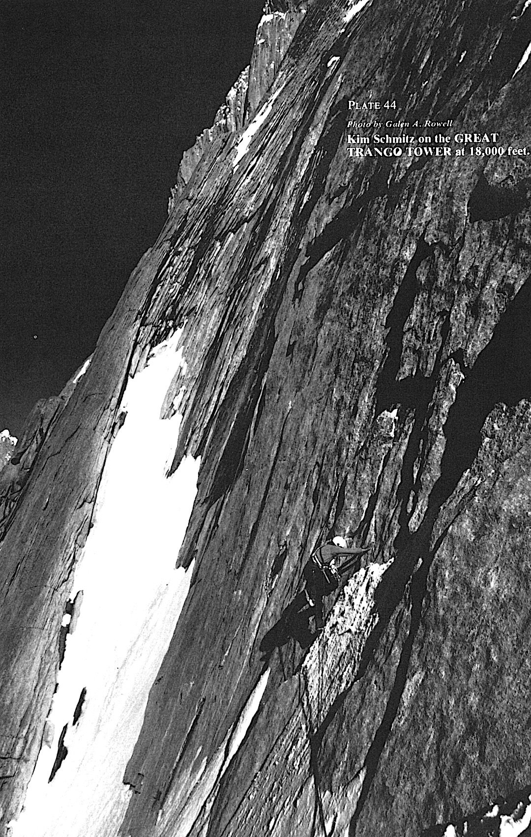
Kim Schmitz on perfect granite at 18,000 feet on the Great Trango Tower. Photo by Galen A. Rowell.

This list wouldn't be complete without the first ascent of Great Trango Tower. After rerouted and canceled flights, Galen Rowell, John Roskelley, Kim Schmitz, Dennis Hennek, and Dr. Lou Buscaglia began their trek through the Shigar Valley up the Braldu River Valley, where they met up with the final member of their team, Dr. Jim Morrissey. Once they established basecamp on Trango Glacier, a four-day storm settled over them, causing debris to fall on their proposed climb.

Telephoto view of Gasherbrum IV and Hidden Peak over Baltoro Glacier from the summit of Great Trango Tower. Photo by Galen A. Rowell.

"The scene greeting us at the base of the gully brought us back to reality and the seriousness of the next 3,500 feet."

On the first day of climbing, Hennek, Rowell, Schmitz, and Roskelley witnessed an avalanche filling the gully they had just ascended, where they believed Buscaglia and Morrissey to be. But "luck stayed with us"— the two had scrambled to the side of the gully to check out a waterfall, the avalanche narrowly missing them. This was only the first day, and it wouldn't be the only hurdle in their journey. Yet the rewards were great. "The afternoon was warm and clear, with an unobstructed, unforgettable view in all directions. We all agreed that there could be no better view of the Baltoro Karakoram." Read about the first ascent while looking at black and white photos from their expedition here

2. Suffer Well: Thirst and Hunger On The Azeem Ridge

Great Trango, Pakistan. Publication Year: 2005. Author: Kelly Cordes.

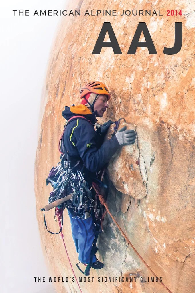
The cover of AAJ 2005: Josh Wharton traversing (5.10+ A1) into the headwall on day 3, about 1,500m up the Azeem Ridge, Great Trango, Pakistan. Photo by Kelly Cordes.

This article stands out in the AAJ archives because of what a saga this ascent turned out to be. Josh Wharton and Kelly Cordes climbed Great Trango’s southwest ridge, which they called the Azeem Ridge (7,400' vertical, 5.11R/X A2 M6), in what they deemed "delusional optimism," "disaster style," and "safety fifth!" climbing. Cordes and Wharton climbed 54 pitches, facing many challenges. On the second pitch, one side of their jury-rigged double-gear slings came undone, causing about a quarter of their cams to fall. Then, halfway up the wall, the two ran out of fuel, leaving them with only one option, sucking on snow in place of drinking water. Cordes wrote: "When we reached the bivouac where our last fuel sputtered out, we never spoke of retreat." On the fourth morning, Wharton's headlamp slingshotted out of his hands and was lost to the tower. Soon after, Cordes’ belay device suffered the same fate. At this point, their only option was up and over. Continue reading about how Cordes and Wharton kept heading up, even against all odds

3. Climbers vs. Technology

Great Trango Tower's Northwest Face. Publication Year: 2000. Author: Jared Ogden. 

Alex Lowe and Mark Synnott with computers at Camp I. Photo by Jared Ogden.

This article was written at the turn of the century when technology and climbing began to clash. Jared Ogden, Mark Synnott, and Alex Lowe faced moral dilemmas about filming and hosting a live internet site during the expedition for their sponsor, Quokka Sports Inc. Quokka.com was one of the only virtual adventure sports websites near the dawn of the internet, until they went bankrupt in the spring of 2001. Ogden, Synnott, and Lowe brought "all assortments of cyberspace technology," including computers and video cameras, and fixed more than 3,000 feet of rope. Foreshadowing today's day and age of viral climbing videos on TikTok and Instagram, this article launched a discussion of technology and its place in climbing. But once on the wall, the team's technology worries disappeared, and they became engrossed in the ethereal alpine world of the Karakoram.

Alex Lowe Cleaning Pitch 30. Photo by Jared Ogden.

The team faced challenges with group dynamics, fever, and "storm-ridden suffer-fests." Through hard-earned adventure, the team produced  Parallel Worlds (VII 5.11 A4, 6,000'). "Our…route combined all the elements of rock climbing: a long free climb up a 3,400-foot slab to a vertical and overhanging headwall that stretches over 2,000 feet, finishing on a knife-edge ridge for 1,000 feet to the West Summit," wrote Ogden. Read about this harrowing adventure and Ogden's tribute to Alex Lowe, who died in an avalanche just a few months after this climb.

Want to read more discourse about technology and its place in the mountains? Read Steve House's hot take on "business climbing" and media regarding the ascent of Parallel Worlds here

4. The Russian Way

Author: Yuri Koshelenko, Russia. Publication Year: 2000.

Parallel worlds: the American (left) and Russian teams hard at work on the headwall pitches on Great Trango's northwest face. Photo by Yuri Koshelenko.

While Jared Ogden, Mark Synnott, and Alex Lowe were putting up Parallel Worlds, Yuri Koshelenko, Alexander Odintsov, Ivan Samoilenko, and Igor Potankina climbed a line to the right of them—parallel up the Northwest Face of Great Trango Tower. The two groups worked hard next to each other for a time, developing genuine mutual assistance, "I was unexpectedly seized by the warm hospitality of the American team. I took huge gulps of piping hot tea from Alex's cup while thinking about the condition of the wet rock," writes Koshelenko. On July 24, after ascending shared fixed ropes, the two groups split apart, and so began the Russian team's arduous journey up dangerous 5.10 to 5.11 free climbing and difficult A3 and A4 sections. Two days later, while climbing a roof, Odintsov ripped off a huge block, tumbling down the face, caught by a well-placed cam but suffering hip and shoulder injuries. Odintsov's fall was just the beginning of their intense battle up the wall. The group faced unstable weather, including snowstorms, multiple uncomfortably close lightning strikes, a dropped haul bag, and dwindling food supplies. Read the epic tale of the ascent of The Russian Way (VII 5.11 A4, 2675m), written beautifully by Yuri Koshelenko, here

"The mountains always accept the tribute, though sometimes the price may seem excessive. But humanity cannot exist without extremes—such is the law of evolution." 

5. Epic Attempts on the Trango Towers

Great Trango Tower and Trango Nameless Tower, Attempts. Publication Year: 2001. Author: Timmy O'Neill 

Miles Smart on the last headwall on Great Trango Tower during the second attempt to climb the southwest ridge. Photo by Timmy O'Neill.

Funded by the American Alpine Club's Lyman Spitzer Climbing Grant, now the Cutting Edge Grant, this trip report chronicles two attempts of the southwest ridge of Great Trango, now the Azeem Ridge, by Timmy O'Neill and Miles Smart. O'Neill and Smart spent almost 50 days on the Trango Glacier waiting out bad weather. During one of their three brief weather windows, they attempted the southwest ridge of Great Trango, an effort "ended with a forced bivy at 18,000" after climbing for 12 hours through 4,000 feet of 4th class to 5.10. They tried again to no avail, despite climbing to within 300 meters of the summit, and moved on to a potential ascent of Eternal Flame on Nameless Tower. Their first attempt on Eternal Flame, "a one-day, single-push climb," ended with a difficult decision to descend six pitches from the summit. Three days later, they "blasted" from the col, ready to summit Eternal Flame. After eight hours of climbing, "the hand of Allah came to catch me and then subsequently thwack me into the wall," writes O'Neill. O'Neill had fallen 100 feet after he short-fixed his rope. Read about the epic attempts on the Trango Towers here

6. Triumph and Tragedy on Great Trango Tower

The Norwegian Buttress, 1984. 

Robert Caspersen, pitch 34. Photo by Per Ludvig Skjerven.

In 1984, a Norwegian team of four, Hans Christian Doseth, Finn Daehli, Stein P. Aasheim, and Dag Kolsrud, attempted the first ascent of the East Face of Great Trango. Due to a lack of food and slow progress up the wall, the team decided to split. Aasheim and Kolsrud rappelled off safely, reaching the Dunge Glacier, while Daehli and Doseth continued on. From the ground, Aasheim and Kolsrud watched via telephoto lenses as their friends reached the summit. Tragically, Daehli and Doseth fell to their deaths during the descent. Their bodies were later spotted at the foot of the climb, but soon after, an avalanche buried them. Their magnificent line was named the Norwegian Buttress. "The triumph had turned into a total tragedy." Read more about the Norwegian Buttress in an article in the 2000 AAJ, which also describes another new route on Great Trango, the Norwegian Trango Pulpit Direct (VII A4 5.11, ca. 2200m).

7. The Grand Voyage

Great Trango Tower, East Face, Swiss-American Expedition, Second Ascent To The East Summit. Publication Year: 1993. Author: John Middendorf. 

Xaver Bongard on Great Trango Tower. Photo by John Middendorf.

We picked this article because of the challenging climbing featured in it and because it was written by the one and only John Middendorf. The recent passing of John Middendorf deeply saddens us, and we invite you to read our tribute to him here.

The Grand Voyage (the Bongard-Middendorf route). This photo doesn’t show the 1984 Norwegian route, which climbed the same buttress, making the first ascent of Great Trango’s East Summit. Grand Voyage started far to the left of the Norwegian route, joined it for three pitches above the big midway ledge, and finished to the right of the Norwegian route. Photo by John Middendorf.

The Swiss-American Expedition, comprised of Swiss Xaver Bongard, Ueli Bühler, François Studiman, American photographer Ace Kvale, and John Middendorf, sought to establish a new line on the east face of Great Trango Tower: The Grand Voyage (Grade VII, 5.10, A4+), which started to the left of the original Norwegian Route and finished to the right. Bongard and Middendorf climbed capsule-style, moving their high camp upward and creating "safe havens" on the wall; they established five camps on the wall, four hanging and one at the snow ledge halfway up. This style of climbing resulted in almost a month on the wall. Ice, snow, and rock fall were high objective hazards for the group. In turn, this created belay stations that were "in suicidal positions." The group climbed the last five pitches below the snow ledge through vertical ice climbing, "rotten aid," and free climbing up a "dangerous steep corner system"—dubbed "Gollum's Gully"—at night due to high objective hazards. "Occasionally, huge sections would exfoliate off the wall and pound down around us." Continue reading about the legendary The Grand Voyage (Grade VII, 5.10, A4+) here

8. Pitch by Pitch, Move by Move: The Other Side of The Grand Voyage 

Great Trango Tower. Publication Year: 1995. Author: Xaver Bongard, Club Alpin Suisse.

John Middendorf and Xaver Bongard on Great Trango Tower. Photo by Ace Kvale.

If you're like us, you can't get enough of the epic story surrounding The Grand Voyage (Grade VII, 5.10, A4+). In 1995, the AAJ published Xaver Bongard's extensive trip report about the expedition, complementing Middendorf’s shorter report. If you love the nitty-gritty details and play-by-play of expeditions, this story is for you. "Pitch 23 was now behind us. To belay, I jammed into a narrow chimney. John, who was larger than I, had no chance of fitting in and continued up the outside. Hauling the sacks, I got up to his level and squeezed back into the crack, first removing my helmet, which was too big to fit in. John continued to climb on the exterior. I was resting from my efforts when I saw him fall and swing in an impressive pendulum." Read about The Grand Voyage from Bongard's perspective here. Tragically, Xaver Bongard was killed in April 1994 in a BASE-jumping accident. This story appeared in the 1995 AAJ as a tribute to him and to provide more information about the landmark Great Trango climb.

9. Stay Tuned: The First Ski Descent of Great Trango

The most recent news surrounding Great Trango Tower involves the first ski descent. On May 9, 2024, Chantel Astorga, Christina Lustenberger, and Jim Morrison skied down the west side of Great Trango Tower. The 2024 AAJ is already off to the printers, and we are eager to get the book into members' hands, so look out for the story in the 2025 AAJ!


Want to learn more about the history of Great Trango Tower and Trango Tower? Read John Middendorf's The Trango Towers in Review article from the 2000 AAJ. Stay on the lookout for our upcoming deep dive into the archives around Nameless Tower and more! 

Want to catch up your reading before the 2024 AAJ comes out?

Artist Spotlight: Marty Schnure & The Art of Maps

By Sierra McGivney

Photo courtesy of Marty Schnure.

In this profile of cartographer Marty Schnure, we uncover the philosophy that has influenced her creation of several beautiful maps for the American Alpine Journal (AAJ), the world-renowned AAC publication that reports the cutting-edge ascents and descents of each year. For Schnure, map-making is about blending geographical information while also evoking and displaying the relationship between that geography and whatever is important about that place to the map user—aka climbing routes, or the animal corridors of that area. Dive into this article to learn about the art of map-making, and how Schure thinks about the responsibility of a cartographer, the power of maps to express an idea, and more.

New Route on The Northeast Face of Pik Alpinist, Kyrgyzstan

Photo by Jared Vilhauer.

A Story from the 2023 Cutting Edge Grant Recipients

By: Sierra McGivney

Dane Steadman (25), Jared Vilhauer (42), and Seth Timpano (41) traveled to the Western Kokshaal-Too in the Tien Shan Mountains of Kyrgyzstan in September 2023, powered by the American Alpine Club's Cutting Edge Grant to attempt three possible objectives. 

Vilhauer and Timpano had known each other since 2010, when they met in Antarctica. The two had climbed quite a bit together: two trips to Alaska, two trips to India, and a lot of ice climbing over the years. The trip was originally just the two of them, but they decided to bring on Steadman to have three people on the trip.

"He's young and keen, and Jared and I are in our 40s, and it's always good to have some younger energy there just to keep it going," said Timpano. 

Each brought something to the team: Timpano has a lot of experience at altitude and climbing steep ice, Jared is an ultrarunner, and Dane is the strongest mixed climber. Each climber had their own strengths, making a well-rounded team. As summer faded into falling leaves and cooler temperatures, they were soon headed for Kyrgyzstan. 


In Seth's Words:

Photo by Jared Vilhauer.

We chose this timeframe based on two factors: 

1) The temperatures are significantly cooler than mid-summer and, therefore, better for ice climbing objectives.

2) The weather seems more stable with less afternoon convective build-up and precipitation. 

However, when winter does come early to the Tien Shan, it can make travel into and out of the region challenging, and most people said we should be out of there before October.  


The East Face of Pik Alpinist was a pipe dream, the least likely of the three objectives they had set their sights on. The photos used for their trip planning showed that the ice up the face of Pik Alpinist was not continuous. The trip as a whole was nebulous, an idea dependent on exploration. They didn't know what they would face until they were in Kyrgyzstan. 

After a week of travel— flying halfway across the world, then driving over bumpy roads deep in the Tien Shen Mountains—the three stood looking at Pik Alpinist. They got excited. Unexpectedly, the ice was in. The other two objectives were explored but were not viable for this season. They would attempt to climb Pik Alpinist. 


In Seth's Words:

After ten days of acclimating and window shopping for different objectives, we set our sights on an elegant and sustained ice line on the Northeast Face of Pik Alpinist (5482m). Given the steep ice climbing on the route, we determined our best strategy was to attempt the route without carrying bivy gear. We left our bivy at the base of the wall at 3 a.m. and crossed the bergschrund (the terminal crevasse), or 'schrund, shortly after that. Using 70m ropes, we made 16 pitches, many of which required 10+m of simul-climbing through difficulties up to AI4 on the steeper pitches and 60+m of simul-climbing on the lower angle sections. 


"[It] was some of the best ice I've ever climbed in the big mountains," said Timpano.

Seth in the blue with white pack. Photo by Dane Steadman.

This was due to the freeze-melt cycle that mimics waterfall ice. The ice was similar to what a climber would find in Montana, Wyoming, or Colorado, sticky and good enough quality for V-threads. However, the rock–compact limestone—proved hard to protect. The crack systems in the wall were brittle and shattered, so they mainly relied on ice anchors. 

As the team ascended, pulling past the mixed crux, the sun began to descend, illuminating the Taklamakan Desert, one of the harshest deserts in the world. All of the days put in planning, scouting, trekking, and traveling for two days of climbing—for this—were coming to a head. They knew they were in for a long night, but the summit was within reach. 


In Seth's Words:

Dane with the red backpack. Photo by Jared Vilhauer.

We gained the summit ridge at 8:15 p.m. and stood on the summit in the dark at 8:30 p.m. on September 24. We simul-climbed down the upper part of the route and then made 18 rappels using our 70m ropes on mostly V-thread anchors. The limestone rock was particularly compact and made rock anchors challenging, both on the way up and down. However, we did leave a few stoppers and piton anchors when the ice was too thin or nonexistent for safe ice anchors. We crossed the 'schrund 26 hours later, making for a 27-hour round trip time on this objective.

Alpine climbing is inherently tricky to grade due to the number of factors that can affect the perceived difficulties (acclimation, health, weather, etc.). Nonetheless, we are calling our new route Trophy Hunt (AI5+, M5, 1100m 'schrund to summit height).

Generally, we found good weather and cold enough temperatures for most objectives, except for those facing due south. We snuck out just before a winter storm covered the roads in snow on September 30.

Finally, we would like to thank the American Alpine Club for supporting this expedition through a Cutting Edge Grant.


"I've received a handful of these over the years, and it's an honor to get it, but it also makes it possible for us, non-sponsored climbers, to do a rad trip," said Timpano.

This grant is made possible by Black Diamond. We encourage all climbers who are pursuing cutting edge ascents to apply for the Cutting Edge Grant, which is open from now until December 31, 2023.


Buried Treasure

Symon Welfringer during acclimatization for the south face of Sani Pakkush in Pakistan. The view is over the Toltar Glacier and up the Baltar Glacier, looking into the heart of the Batura Muztagh and beyond. Photo by Pierrick Fine

11 Minute Read

A Personal Guide to the 2021 AAJ

By Dougald MacDonald, Editor

Even though COVID-19 forced an abridgment of the American Alpine Journal—about 150 pages shorter than normal—it’s still very unlikely anyone has read the 2021 edition cover to cover, except for the editor in chief. That’s me. Each year, while editing the AAJ, I see gems in these pages that many readers may miss. So, here’s my annual insider’s guide to some memorable pieces from the 2021 edition, plus bonus photos that appear exclusively online. (To see the Buried Treasure guide to the 2020 AAJ, click here.) I hope these notes inspire you to take a second look at that AAJ sitting on your bedside table or in the reading basket in your bathroom. You never know what you might find!

This online feature is made possible by Hilleberg the Tentmaker, lead sponsor of the AAJ’s Cutting Edge Podcast. 

North Howser Tower, Canada

Enticing double cracks on Voodoo Chile, a new route in the Bugaboos. Photo by Alik Berg

If you judge by Instagram likes, the most popular AAJ story of 2021 was Uisdean Hawthorn’s report about a new route up North Howser Tower in the Bugaboos. Yet I’m betting most people didn’t even notice the short report in the AAJ, mainly because this cool photo of an alluring double-cracks pitch—which attracted all the Instagram attention—appeared only online. With 11 pitches and a short 5.11+ crux, Voodoo Chile is a relatively accessible route up North Howser’s daunting west face—at least compared with the huge routes farther left. Every AAJ is packed with enticing objectives, but nothing is more enticing than a route one might actually try someday!

Photo by Bradford McArthur

Call of the Sirens, Canada

The AAJ is filled with great writing, but unless you’re interested in a particular climb or region, you might never read many stand-out pieces. Lots of readers likely missed Jacob Cook’s saga about his three-year quest to climb a multi-pitch slab testpiece in Squamish, British Columbia, originally bolted by the late Marc-André Leclerc. In my opinion, no writer has done a better job of capturing the frustrating and occasionally magical intricacies of high-end slab climbing. Plus, the story has a cool surprise ending. If you didn’t see it, turn to page 103 of this year’s AAJ or read the full story here.

Sani Pakkush, Pakistan

Symon Welfringer during acclimatization for the south face of Sani Pakkush in Pakistan. The view is over the Toltar Glacier and up the Baltar Glacier, looking into the heart of the Batura Muztagh and beyond. Photo by Pierrick Fine

It’s difficult to publish panoramic photos effectively in the AAJ, especially when there’s a climber or other key element right in the middle of the photo, as is the case with the gorgeous image above. To make the most of a panorama in our 6-by-9-inch format, you’d have to run it across a full spread in the book, and in this case the climber would have disappeared into the “gutter” between the pages.

I always encourage readers to visit the online versions of stories like Symon Welfringer’s article about the south face of Sani Pakkush, because most of our stories have extra photos at the website. Pro tip: Drag photos of interesting peaks and walls to the desktop of your computer to blow them up for close examination.

 Pik Communism, Tajikistan

Iron-hard ice on the bitterly cold north face of Pik Communism in January 2020.

While editing the AAJ, I often think of the classic essay “Games Climbers Play,” by Lito Tejada-Flores, originally published in the 1967 Ascent. In a concept that seems obvious today but was novel at the time, Lito proposed that climbing was no longer one sport but instead “a collection of differing (though) related activities, each with its own adepts, distinctive terrain, problems and satisfactions, and perhaps most important, its own rules.” The games he outlined included bouldering, crag climbing, big walls, super-alpine, and more. Since then, the “games climbers play” have continued to expand in number and complexity, often providing new ways for climbers to enjoy mountains relatively close to home. 

All of which is a roundabout way to call attention to a report from Tajikistan in AAJ 2021, describing a new route up 7,495-meter Pik Communism, climbed by a Kyrgyz and Russian team in January 2020. The story also reveals a new “game” pursued by certain climbers in the former Soviet Union: the Winter Snow Leopard. Traditionally, Snow Leopards are mountaineers who have climbed the five great high-altitude mountains of the former USSR. Until 2020, this feat had never been completed in winter, though Kazakh climber Valery Khrishchaty climbed four of the five during the late 1980s and early ’90s. With his ascent of Pik Communism in January 2020, Sergey Seliverstov completed the quintet, followed shortly thereafter by Alexey Usatykh and Mikail Danichkin during the same expedition.

Mt. Logan, Canada

A long way from anywhere during the 2019 ski around Mt. Logan. Photo by Thomas Delfino

We used the COVID-19 travel hiatus to catch up on some expeditions in the AAJ that we had missed earlier. Among these reports, my personal favorite is one that I’d been chasing for a couple of years: an extraordinary French expedition to Mt. Logan in Canada in the spring of 2019. Thomas Delfino, Grégory Douillard, Alexandre Marchesseau, and Hélias Millerioux started from the village of Yakutat, Alaska, and over the next 48 days, team members walked, skied, and rafted more than 650 kilometers in a great arc around Mt. Logan. Along the way, three of the climbers summited Canada’s highest peak and made the most complete ski (and snowboard and monoski) descent of the enormous and technical east ridge. It was a tour de force, and as often happens in the AAJ, we had nowhere near enough pages to highlight their incredible story, but at the AAJ website you’ll find a map, lots of good photos, and a wonderful film of the expedition.

Oso Scary, Wyoming

The roped-solo first free ascent of the north face of Sundance Pinnacle in the Wind River Range was impressive. But it’s the subsequent bear story (and the brilliant route name) that’s most memorable in Kevin Heinrich's short report in AAJ 2021. His topo is pretty classy, too. Find Kevin’s Oso Scary story at publications.americanalpineclub.org.

Joe Brown, 1930 – 2020

Photo by John Cleare

In AAJ 2021 we published In Memoriam tributes to three great mountaineers from the United Kingdom: Joe Brown, Hamish MacInnes, and Doug Scott. The Joe Brown tribute was written by Ed Douglas, the leading mountaineering journalist in Great Britain in recent years. As with many of Ed’s articles, it is filled with insights and personal remembrances made possible by a long career of writing about (and climbing with) legends of the sport. I encourage you to read it at page 210 of this year’s book or at our website, or check out the longer version from which our piece was adapted, originally published at the British Mountaineering Council website. Ed serves as editor of The Alpine Journal, the annual publication of the Alpine Club in the U.K., which has been published since 1863—that’s more than 65 years older than the American Alpine Journal. Each year, Ed helps out the AAJ in many ways—it’s an honor to collaborate with him. 

Gros Morne National Park, Canada

Casey Shaw and Joe Terravechhia in Gros Morne National Park, Newfoundland.

Since the 1990s, successive editors of the AAJ have been hoping to publish a comprehensive article on the gigantic ice climbs of western Newfoundland. Joe Terravecchia and Casey Shaw, the leading protagonists of ice climbing in Gros Morne National Park, weren’t exactly opposed to publishing their climbs, but they did seem to stall for quite a long time—just long enough to climb all the plums. More recently, they’ve both been too busy with work and other pursuits to invest much time in writing an article. It took a third party—Alden Pellett from Vermont, himself one of the leading activists in Newfoundland ice climbing—to herd the cats and make this story happen.

I was especially happy to cajole Casey Shaw and Bernie Mailhot into writing personal accounts of some of their Newfoundland climbs. Both are delightful stories—Casey’s a loving account of the 1999 first ascent of  Captains Courageous, the tallest ice climb in eastern North America, and Bernie’s a very funny tale about a 2004 trip that epitomized the area’s difficult and rapidly changing conditions. Both pieces focused on the Newfoundlanders the two men befriended—a rich reminder that climbing expeditions are almost always as much about the people you meet as the routes you climb. 


This year in review and the AAJ’s Cutting Edge podcast are both presented by Hilleberg the Tentmaker. 2021 was Hilleberg’s 50th year in business; it started as a forestry products company in Sweden and morphed into the tent maker we know today. Visit Hilleberg’s website to order “The Tent Handbook,” their uniquely informative catalog.

Buried Treasure

An all-time base camp in the Khane Valley of Pakistan. Photo courtesy of Konstantin Markevich

A personal guide to less-visible highlights of the 2020 AAJ 

By Dougald MacDonald, Editor

The American Alpine Journal is a 368-page book, and there’s probably only one person who reads it cover to cover: me. As editor in chief, I see and read everything multiple times, and each year a few parts of the book are particularly memorable—because of the quality of the writing or photography, because of the thrill of opening a folder of photos from little-known mountains, or because of the detective work that may go into a single sentence. But even if you did read every page, you wouldn’t see it all, because we can’t fit everything into the book—some of the coolest elements of the AAJ reside exclusively online.

Here, I offer an insider’s look at eight gems buried within the pages of the 2020 edition or hosted only at the AAJ website. In this guide, I’ve purposely skipped over the featured articles in the book. So, this is not a “best of” or an editor’s choice. Consider it a treasure map.

This special feature is made possible by Hilleberg the Tentmaker, lead sponsor of the AAJ’s Cutting Edge Podcast. 

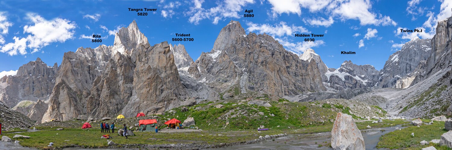
TANGRA TOWER, PAKISTAN

The Krasnoyarsk Route on the southeast face of Tangra Tower (5,820 meters). Photo by Konstantin Markevich

The AAJ’s 6-by-9-inch format does not handle panorama photos well, and the stunning photo at the very top of this page had to be cropped tightly for the book. At full width, it must be one of the most enticing photos for alpine rock climbers that we’ve ever published. The 2019 Russian expedition to the Khane Valley in the Karakoram climbed three peaks, including glorious Tangra Tower and the south summit of The Thumb (mislabeled as Trident in the photo above).

By the way, the first expedition to publish extensive photos of the Tagas Group, as this area is known, was a Bulgarian team in 2010. Their report and more photos were in AAJ 2011.

MT. BREITENBACH, IDAHO

One of the simple pleasures of my job is learning about unfamiliar mountains and ranges—even those within a few hundred miles of my home in Colorado. Marc Hanselman’s report about a new route up the north face of Mt. Breitenbach in Idaho’s Lost River Range, was one of these. I’d never even heard of Breitenbach, but for climbers who can nail the timing for good alpine conditions (this ascent was right after the summer solstice), the north face is an impressive target. Marc’s new route, climbed with Paddy McIlvoy, was possibly only the second line up this rugged face. All other known parties have climbed the original route, the Grand Chockstone Couloir, first done back in 1983. Talk about hidden gems!

Paddy McIlvoy on Cowboy Poetry (2,800’, IV 5.7 R AI2 50˚ snow) on the north face of Mt. Breitenbach (12,140’) in Idaho. Photo by Marc Hanselman

THE EIGER OF THE INYO, CALIFORNIA

Natalie Brechtel wondering what she got herself into as she completes the fifth pitch of the Northeast Buttress (1,300’, IV 5.9 R/X) of Pleasant Point. Photo by Richard Shore

AAJ colleagues know that I have an inordinate fondness for offbeat adventures (girdle traverses, kayak-and-climb extravaganzas, remote and arduous exploration, etc.). Climbing super-hard routes is impressive, but I also like to make space in the AAJ for creative climbing—even when the routes are highly unlikely to become classics. In AAJ 2020, a good example was Richard Shore’s exploration of “The Eiger of the Inyo,” the east face of Pleasant Point in the Inyo Mountains. Shore and Natalie Brechtel completed the first full route up the 1,000-foot wall of shattered limestone and dolomite. “[We] climbed what we deemed to be the ‘safest’ route on the far right side of the peak,” Shore wrote in his AAJ report. “Safe is a relative term on this cliff—torrents of climber-induced rockfall are inevitable, and the dolomite is so sharp that a fall by leader or follower seems likely to cut the rope. Steeper technical sections were interspersed with narrow alpine ridges, and most pitches took an hour or more to lead, due to navigational and protection difficulties in the choss. Soft-iron World War II Army surplus pitons proved to be most valuable—bolts were often worthless in the shattered mess, and hard steel pins would explode the rock into bits.” I can’t get enough of this stuff, and neither, apparently, can Richard Shore. He returned later the same year with Myles Moser for a harder, more direct line up the Inyo Mordwand.

JEBEL KHAZALI, JORDAN

Christian Ravier is a French guide who frequently works and climbs in Jordan (he also wrote the climbing guide to the Taghia Gorge in Morocco), and his report in AAJ 2020 brought us up to speed on some recent routes up the sandstone walls of Jebel Khazali in Wadi Rum. But it was his beautiful hand-crafted topos, complete with watercolor paintings (like this one of local guide and camp host Atayek Hamad), that really caught my eye. Christian’s unique topos weren’t suitable for our print edition, but three of these beautiful references can be seen with his report at the AAJ website. The rock looks pretty amazing, too!

LA GLORIA, MEXICO

We opened the Mexico section of AAJ 2020 with a scenic shot of La Gloria, a stunning mountaintop pyramid of limestone in the mountains west of El Salto in Nuevo León. As beautiful as Zach Clanton’s photo was, however, it didn’t convey the full allure of the climb: a 13-pitch 5.12 up the pillar splitting the south face. It’s an interesting lesson in the power of a route line drawn onto a photo—in this case, a photo that’s only available online. However you look at it, this is a fantastic piece of rock, which seems destined for popularity. Zach’s report at the AAJ website tells the full story of Rezando, the route he developed with Dave Henkel: “To me, the southern pillar of this peak was the Mexican Beckey-Chouinard, a line of perfect blue-orange limestone just begging to be the range’s first alpine sport climb.”

The south pillar of La Gloria (9,688 feet), showing the 1,500-foot route Rezando (13 pitches, 5.12). Photo by Zach Clanton

SIULÁ GRANDE, PERU

Luis Crispin leading out on the upper shoulder of the southeast ridge of rarely climbed Siulá Grande in Peru. Photo by Nate Heald

Nate Heald, a guide based in Cusco, Peru, has been a frequent contributor in recent years, climbing numerous new routes, mostly in the country’s southern ranges. In AAJ 2020, he reported on an ascent that was personally meaningful, in part because of the presence of his frequent partner Luis Crispin, who roped up with the teenage Thomas Schilter to become the first Peruvians to climb Siulá Grande in the Cordillera Huayhuash—and by a new route: Peruana Supreme (1,000m, TD AI4). In recent years, the AAJ has reported many new routes and first ascents of peaks by “local” climbers, throughout Latin America as well as in Pakistan, India, Nepal, and other mountainous countries. Many of these climbers work as guides but increasingly pursue their own ambitions in their local mountains.

Heald wrote in the Siulá Grande report: “I met Luis in 2011 on my way back to Cusco after a climb; he lives in a village at 4,300m below Ausangate and began assisting his uncle with tourist treks when he was 12 years old. He worked with me as I established my guiding agency, and since then we have done many climbs together. From my observations, Luis did not start climbing for any other reason than curiosity and camaraderie. He loves the natural world and has vast knowledge of it, and, at first, I think he just wanted to know what it would be like up there in the snow and ice. Luis and Thomas roped up together on Siulá Grande so no one could suggest they hadn’t made a purely Peruvian ascent of the peak.”

RAGGED RANGE, NORTHWEST TERRITORIES, CANADA

Amy Pagacz on top of a small peak in the Ragged Range after climbing Twisting Couloir (350m, AD). The high peak behind Pagacz is one of several mountains labeled Mt. Sidney Dobson on maps. This one is likely unclimbed. Photo by Wojtek Pagacz

Occasionally, AAJ editors get sucked down the rabbit hole of climbing archives. In AAJ 2020, we printed a short report about an interesting expedition to the Ragged Range in northwest Canada’s Logan Mountains—very few climbers have visited these mountains, which lie south of the popular Cirque of the Unclimbables, at the headwaters of the Fool’s River. The 2019 team climbed a few summits but couldn’t find a good approach to one of their biggest targets, which is labeled “Mt. Sidney Dobson” on many maps of the area. During the editing process, we realized that this Sidney Dobson had in fact been climbed way back in 1952 by an extraordinary expedition of Yale University students. The Yalies spent two and a half months in the area, built a log raft to cross a lake and access the mountains, and subsisted in part on game they shot and smoked, en route to summiting nine peaks, mostly first ascents. A great account of their trip is in the 1953 Canadian Alpine Journal.

Digging deeper, we realized that at least four different peaks in this cluster of mountains, all around 2,600m in elevation, have been called Sidney Dobson by various maps and publications. I spent hours attempting to determine which of the “Sidney Dobson” peaks might be the highest and whether it had been climbed, but the surveys are inadequate and the 2019 team couldn’t tell which was highest from their vantage points. Amy Pagacz’s expedition report and my attempt to unravel the Sidney Dobson mystery are both at the AAJ website. Unfortunately, the 2019 team found mostly poor rock on these impressive mountains and walls. But the first ascent of at least one Mt. Sidney Dobson may still be waiting.

MT. RORAIMA, GUYANA

Edward James lowers out on the Great Northern Prow of Mt. Roraima, watched by Troy Henry. The two men are from a nearby Akawaio community and had never worn a harness before the expedition. Photo by Matt “Pikey” Pycroft

Leo Houlding is a polished storyteller as well as a great climber, and his three-page story in AAJ 2020 about a new route on the northern prow of Mt. Roraima in Guyana is an excellent read. One of the highlights of this expedition was the role of Troy Edwards and Edward James, who live in the Akawaio village of Phillipai, the nearest settlement to the mountain. After guiding the British team to Roraima, the two accepted the Brits’ invitation to carry on up the wall, despite the fact that neither had ever climbed, jumared, or even worn a harness. In the end, they became the first people of Guyana to summit their country’s most famous mountain.

Sadly, we had to cut a full page and a photo from Leo’s story at the last minute, and three pages in the book didn’t come close to being enough for this tale. In fact, no article is as good as hearing Leo tell a story in person, so I highly recommend Chris Kalman’s interview with Leo for episode 27 of the AAJ’s Cutting Edge podcast. It’s great stuff.


The Cutting Edge and this AAJ year in review are both presented by Hilleberg the Tentmaker. Visit their website to learn more about their famous tents and order “The Tent Handbook,” Hilleberg’s uniquely informative catalog.

K2 1953: The Third American Karakoram Expedition

by Eric Rueth

Camp V (22,000 ft.) with Mashrabrum [sic] in the background. Photo, Third American Karakoram Expedition.

For the third and final installment of our pre-2018 Annual Benefit Dinner Americans on K2 wrap-up, we’ll take a look at the Third American Karakoram Expedition in 1953. It doesn’t seem possible to start this blog post better than the way Robert Bates started his article about the expedition in the 1954 American Alpine Club Journal,

 “On 2 August 1953 all eight members of the climbing party of the Third American Karakoram Expedition, in excellent physical condition, were camped at 25,500 feet on K2 with ten days’ food. The summit of the second highest mountain in the world (28,250 ft.) rose less than 3000 feet above us. It was our hope to establish two men at Camp IX, at 27,000 feet or slightly higher, on August 3rd; and on the following day, if all went well, to thrust at the summit.”

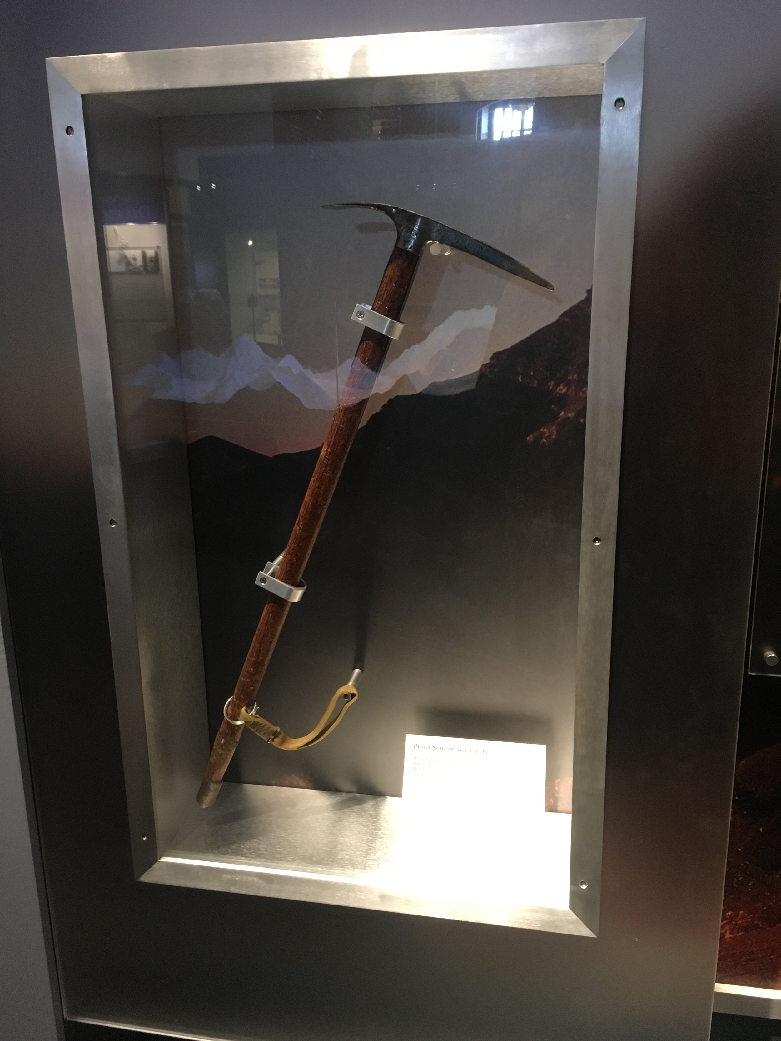
The men high up on K2 were Dr. Charles Houston, Robert Bates, George Bell, Robert Craig, Arthur Gilkey, Dee Molenaar, Peter Schoening and Capt. H. R. A. Streather.  After the 1938 First American Karakoram Expedition, Houston and Bates had been dreaming of returning to K2. Delayed by World War II and political conflicts between India and Pakistan they were finally able to return to K2 15 years later for a second attempt at the summit.

The optimism of reaching the summit by those eight men on August 2nd was met with a multi-day storm. At Camp VIII (25,500 ft.), the party was battered by heavy winds. One tent was completely ripped apart, forcing its occupants to seek refuge and residence in nearby tents. Even worse, the wind made keeping stoves alight impossible. Without being able to keep the stoves consistently lit, the party could not melt enough snow to stay hydrated.

After five days of being tent bound and becoming increasingly dehydrated, the storm began to lull. Now that it was possible to hear each other over the wind discussion of pushing higher up the mountain arose. But again optimism was met with disaster. When Gilkey emerged from his tent on April 7th, he immediately passed out.

Gilkey passed out from the pain that a charley horse had caused him. That charley horse turned out to be thrombophlebitis. Gilkey had blood clots in his leg. Getting Gilkey off of the mountain was now the main objective but hope still remained for an attempt on the summit. The party immediately broke camp to begin the descent, only to be turned back by the likelihood of an avalanche along the route. The storm raged on and the party bunkered down. On August 11th, the party’s hand was forced, Gilkey now had a clot in his other leg and more seriously in his lungs.

Capt. Streather at Camp III. Photo, Third American Karakoram Expedition

With the storm still raging, there was no other option than to descend. Any thoughts of a summit attempt were abandoned. Getting Gilkey down was now the only objective. Gilkey, who was unable to walk, was wrapped in his sleeping bag and the remnants of the destroyed tent; he would have to be lowered down the mountain.

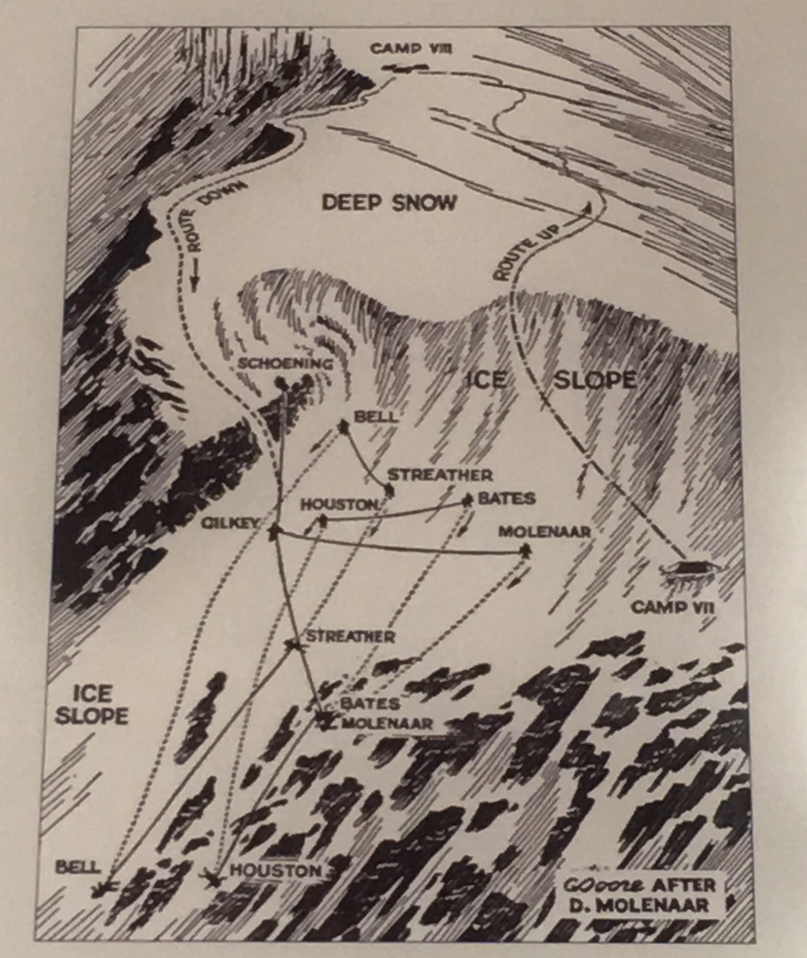
The going was slow and required every ounce of strength and focus from the party. The route used to climb up the mountain did not work for descending now that Gilkey had to be lowered. Schoening and Molenaar led the descent by finding a suitable route. The rest of the party would belay Gilkey and each other.

On the steepest pitch of lowering, the storm obscured the line of sight and made vocal communication with others below futile. First Schoening and Molenaar disappeared into the storm. Then Craig escorted Gilkey while he was being lowered until he too disappeared. Streather descended to a point where he could see Craig’s arm signals and relay commands to the rest of the party belaying. Already physically exhausted by the task of lowering Gilkey and being battered by the storm, those belaying were in for a test. Streather turned to the group and shouted, “Hold tight! They’re being carried down in an avalanche!” The group, the ropes, and the anchors held fast. Craig, who was not tied into any ropes, grabbed the ropes lowering Gilkey and held on for the duration.

Following the avalanche, the party was absolutely exhausted. The party was close to the small ledge that served as Camp VII. Craig traversed to the Camp VII to gather himself after surviving the avalanche and to attempt to enlarge the ledge so the entire party could recuperate from the physically and mentally demanding day.

With Craig at Camp VII, the rest of party continued the extremely slow process of working their way towards the ledge. Bell was working his way over a difficult stretch of an ice gully when another catastrophic event occurred, Bell lost his purchase and started falling down the mountain. The hard ice prevented a self-arrest by Bell and Streather, who was tied into the other end of Bell's rope. The location of the pair when they fell set off a chain reaction that would send the entire expedition, except for Craig alone at Camp VII, down the mountain to the Godwin-Austin Glacier two miles below.

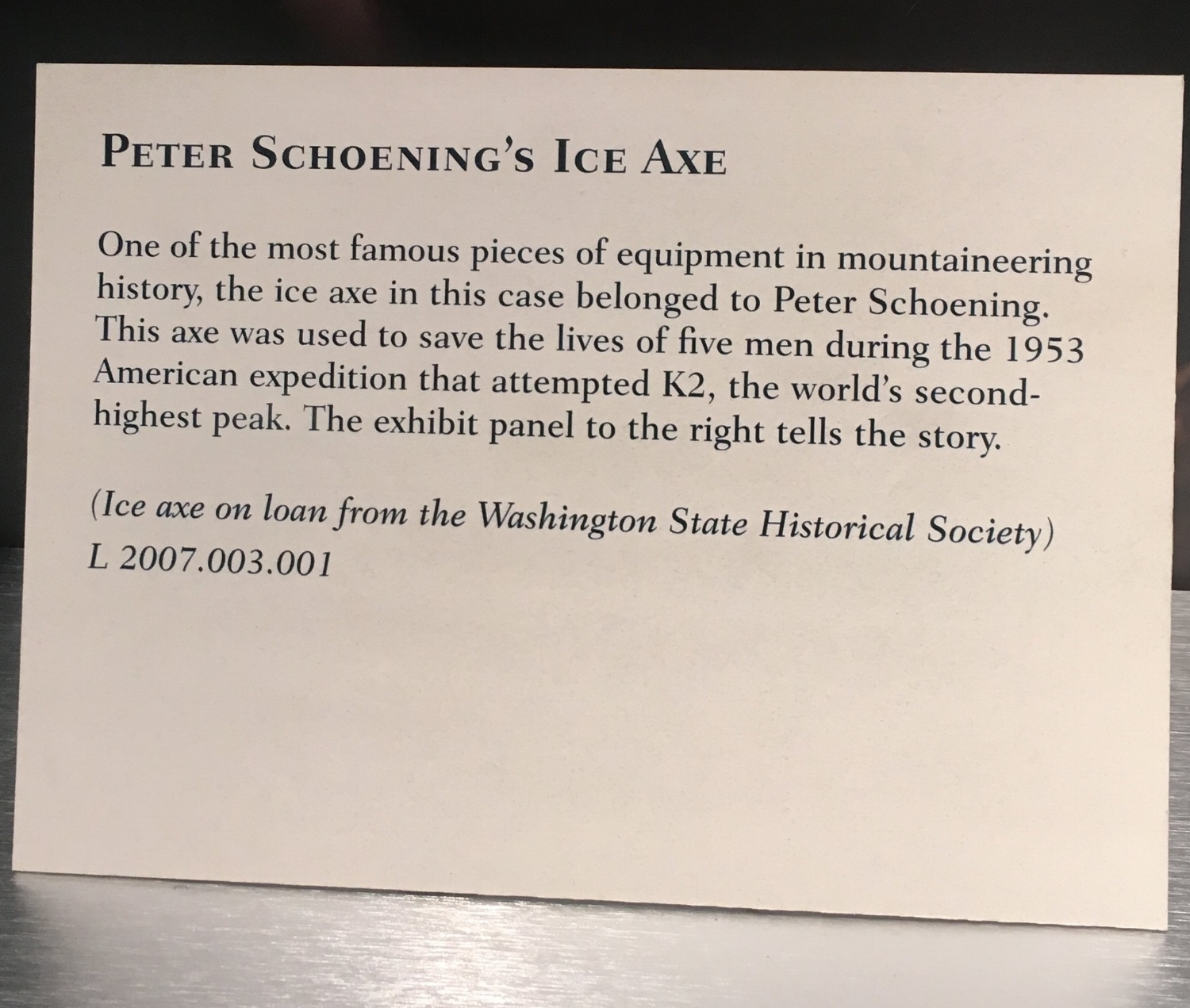
Only the entire expedition didn’t disappear over the edge of the mountain and fall two miles through the void. As members one by one were caught up in ropes and pulled from their feet, they tumbled and somersaulted downwards picking up momentum along the way until all of a sudden the rope grew taught. Schoening arrested the fall of his six companions in a moment that will forever be known as, “the belay.”

The entanglement that caused the catastrophic fall down the mountain also worked to save the expedition. Various injuries and lost gear resulted but the expedition suffered no loss of members.

This diagram by Clarence Doore follows an illustration by Dee Molenaar. It is one display at the American Mountaineering Museum.

Eventually making it to Camp VII the ledge still needed to be bigger before tents could be set up and the party could put the horrific day behind them. Gilkey was secured with two ice axes beneath a rock rib while the space was expanded. When camp construction was completed Streather, Craig and Bates went to retrieve him. Only, upon their arrival at the rock rib they found a bare slope. Gilkey and his anchors were gone, swept away by an avalanche.

The night that followed the horrific day would offer little rest. The party had been pushed to the limit physically, mentally, and emotionally and were now cramped together in two tents on a precarious ledge. The storm still raged on and Houston, who had suffered a concussion, would wake up in a state of confusion consequently waking up everyone else.

The next day the storm continued and so did the party. It took four days for the battered party to descend from Camp VII to Camp II. At Camp II, the party was met by porters who provided food and comfort after their heroic and tragic descent.

As they departed the mountain, the expedition built a large cairn memorial for Gilkey near the confluence of the Savoia and Godwin-Austen Glaciers. The memorial still stands to this day and has grown to be more than a memorial only to Art Gilkey; the Gilkey Memorial is now used to remember all who have perished on the Savage Mountain.

With the conclusion of the 1953, there had been three attempts made by Americans on K2. The first had been successful as a reconnaissance but failed to reach the summit. The following two ended without the summit being reached and tragic loss of life. Americans had paid a high price for their efforts on the mountain and it wouldn’t be until 1978 that the mountain would finally yield to Americans.

Read about the Second American Karakoram Expedition here.

Read about the First American Karakoram Expedition here.

*These blog posts were an attempt to sum up the American attempts on K2 prior to the successful expedition in 1978. Unfortunately they leave out a lot of the nitty gritty details and personalities of those involved. If your interests have been piqued you can read the full expedition reports in the American Alpine Club Journal at publications.americanalpineclub.org or if you're an AAC member you can checkout some of the many books about K2 in the AAC Library at booksearch.americanalpineclub.org.

By Eric Rueth

AAC Launches Cutting Edge Podcast

CE_Square.jpg

We're excited to announce the launch of The Cutting Edge: Voices from the American Alpine Journal. The new monthly podcast features in-depth, tightly focused interviews with climbers who've just returned from ground-breaking ascents all over the world. 

The first episode features Will Stanhope, interviewed by AAJ Associate Editor Chris Kalman, giving us the lowdown on an incredible linkup in the Bugaboos with Leo Houlding. 

The Cutting Edge is available now at iTunes, Soundcloud, Google Play, Stitcher, and other sites. Special thanks to Wyoming climber and musician Jason Tyler Burton for the original sound effects and tunes he created for this show.
Enjoy and if you like what you hear, please share!